Managing Director’s Message

Since the start of our service in February 2008, we have being thriving to bring the best service in the country and our pursuit for excellence is the motive force that drives our company to grow and gain the trust of our loyal clients. Equipped with the best technology we provide a comprehensive range of survey, which includes a topographical survey, Cadastral survey, and engineering survey. Om Survey with its team of professionals is the key to the companies’ impressive growth during this short period of time. And our sincere thanks to our clients for their support. We are truly committed to providing you with professional service “for all your surveyors’ job”.
About Om Survey Consultancy Vadodara

At Om Survey Consultancy Vadodara, we take the opportunity to introduce ourselves as a well-established firm in the field of land surveying, civil engineering related services based in Vadodara. In this period we carry with ourselves a wide experience in the field of Topographical mapping and also specialize in providing customized GIS & other CAD-related solutions for survey and civil engineering field swell. We provide services like Land Survey, Land Survey in Baroda, Digital Land Survey, Topographic Land Survey in Vadodara, Total Station Land Survey, Project Land Survey, Railways Survey Services, Powerline Survey Services, Contour Survey Services Land Survey in India.
We possess the latest infrastructure an instruments like GPS / Total Station with technological excellence for surveying an data collection. Our team comprises experienced an highly qualified Ex-Surveyor’s Civil Engg’s from SOI, PWD, IRRIG etc, and CAD experts & skillful Draughtsman.
OM SURVEY CONSULTANCY was registered and incorporated as a Surveying and GIS Mapping Consultant Company on the 1st day of June 2008 with a mandate to carry out surveying, mapping, planning, and engineering consultancy services.
The company is fully registered with Income tax department (PAN NO: AHGPC0833L), GST Registration No. 24AHGPC0833L1ZN, EPF NO. (Code: GJ/BRD/66706). We also register with Micro, Small & Medium Enterprises (MSME) UAN No GJ24E0006511 and Aadhar No. 530036201043.
Our Clients include but not limited to Private Real Estate Developers, Major construction Companies, Architects, Engineering Design Firms, Mining Companies, and Valuers among Others.
OM SURVEY CONSULTANCY consists of a well-experienced team of registered surveyors and a Professional management team. Our team has the technical expertise, equipment and the technology to deliver the best solutions to our clients; and to our clients’ our company is known to be reliable, delivers projects on time and within an agreed budget, and adheres to the highest ethical industry standards.
We strive towards the provision of professional services to the ever-growing market for surveying and mapping services putting the satisfaction of our clients as a first priority.
Mission Statement

To provide surveying, mapping and engineering services in an efficient and professional manner putting the client as our first priority.
Vision Statement

To be the best surveying and mapping services provider in India and beyond.
Equipment

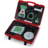
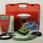
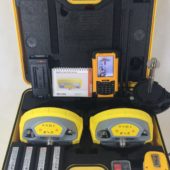
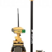
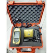
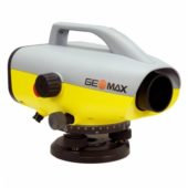
We continue to invest in the latest technology to provide accurate data. Our Leica Total Station, Leica GPS Systems and Geomax allow our team with the upmost accuracy and confidence when locating data in the field. We also utilize a range of quality software products and databases including Leica Geo-office, Model Maker and Global mapper etc. to produce quality plans in a range of formats for our clients.
| INSTRUMENTS | SETS |
|---|---|
| DGPS LEICA GS-10 (L1+ L2) | 16 |
| DGPS LEICA 500 (L1+ L2) | 10 |
| DGPS GEOMAX ZENITH 25 (L1+L2) | 10 |
| DGPS TOPCON HIPER GA (L1+ L2) | 06 |
| DGPS TOPCON GRS1 (L1+ L2) | 06 |
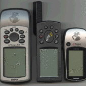
| MAGELLAN HAND HELD GPS | 02 |
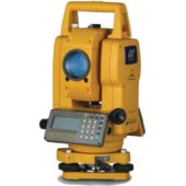
| TOPCON -235 TOTAL STATION | 03 |
| TOPCON -720 TOTAL STATION | 01 |
| GEOMAX DIGITAL LEVELS ZDL700 | 02 |
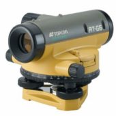
| TOPCON AUTO LEVEL | 03 |
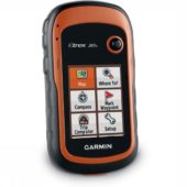
| GARMIN ETREX GPS | 02 |
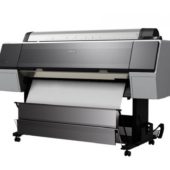
| EPSON PLOTTER-9700 | 01 |
| CAMERA | 06 |
| COMPUTER & LAPTOP | 40 |
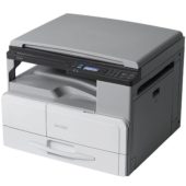
| XEROX MACHINE | 02 |
Software

AutoCAD Land development, Civil 3D, 3DS Max 7, Photoshop for architectural designs, Subdivision designs for Real Estate Development as well as mapping.
GIS (Geographical Information Systems)/ GPS (Global Positioning Systems) Software Arc View GIS, Arc GIS, ExpertGPS and GPS/CAD Converter for managing of GIS/GPS Projects.
Data Downloading Software
This software helps ease downloading of data from hardware such as Total Stations, RTK systems, Handheld GPS and so forth. This software includes but not limited to Topo survey, Topcon Link, Garmin Trip, and Waypoint Manager and Mapsend Manager Software and Other Softwares.

